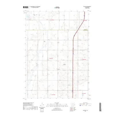
2017 Map of Colton SE
USGS Topo · Published 2017About this map
Skunk Creek meanders through the western portion of this landscape, carving a valley within the larger Coteau des Prairies upland region. This 2017 survey documents the agricultural character of Minnehaha County, where the land is organized into a precise grid of township roads and county highways. Cultural landmarks are primarily concentrated along these thoroughfares, including the Willow Creek Lutheran Cem and the smaller Burk Cem situated north of Co Hwy 104. In the northwest, Anderson Slough provides a natural contrast to the surrounding section lines. The presence of Jensen Airport west of 420th Ave indicates the modern infrastructure integrated into this rural setting, while the eastern boundary near the Moody County line is defined by the prominent route of Interstate 29.
Find a feature on this map
28 named features on this map. Tap any name to fly to it.
Don’t see what you’re looking for? This feature index may not catch every label — zoom into the map to look around manually.
Map Details
Editions of this 2017 Colton SE Map
This is the sole edition of this map. No revisions or reprints were ever made.
Other maps of this area

1955 · Sioux Falls
USGS Topo · 1:250,000

1958 · Sioux Falls
USGS Topo · 1:250,000

1962 · Colton SE
USGS Topo · 1:24,000

1962 · Dell Rapids
USGS Topo · 1:24,000

1962 · Renner
USGS Topo · 1:24,000

1962 · Hartford North
USGS Topo · 1:24,000

1962 · Crooks
USGS Topo · 1:24,000

1963 · Trent
USGS Topo · 1:24,000

1963 · Colman
USGS Topo · 1:24,000

1968 · Wentworth
USGS Topo · 1:24,000