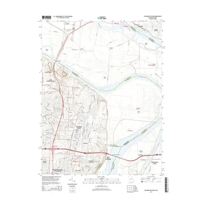
2015 Map of Columbia Bottom
USGS Topo · Published 2015About this map
The Missouri River and Mississippi River reach their confluence just beyond the boundaries of this survey, defining a landscape of low-lying islands and complex hydrology. The massive Columbia Bottom conservation area and Chouteau Island dominate the riverine geography, while the Chain of Rocks Bridge provides a vital link across the water near St. Louis. This area is characterized by its dual identity as both a major industrial and transit corridor—evidenced by the Chain of Rocks Canal and proximity to Granite City—and a region preserved for its natural floodplains.
Find a feature on this map
78 named features on this map. Tap any name to fly to it.
Don’t see what you’re looking for? This feature index may not catch every label — zoom into the map to look around manually.
Map Details
Editions of this 2015 Columbia Bottom Map
This is the sole edition of this map. No revisions or reprints were ever made.
Other maps of this area

1888 · St. Louis
USGS Topo · 1:62,500

1927 · Alton
USGS Topo · 1:62,500

1927 · St. Charles
USGS Topo · 1:62,500

1933 · Granite City
USGS Topo · 1:24,000

1933 · Clayton
USGS Topo · 1:24,000

1933 · Saint Charles
USGS Topo · 1:62,500

1934 · Alton
USGS Topo · 1:62,500

1935 · Granite City
USGS Topo · 1:24,000

1935 · Florissant
USGS Topo · 1:24,000

1935 · Monks Mound
USGS Topo · 1:24,000