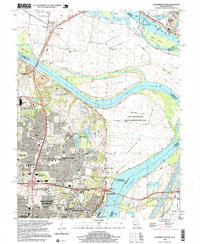
1998 Map of Columbia Bottom
USGS Topo · Published 1999About this map
The confluence of the Mississippi River and Missouri River dominates this late-twentieth-century landscape, where industrial infrastructure meets expansive conservation lands. The Columbia Bottom State Conservation Area occupies the massive flood-plain peninsula created by the meeting of these two great waterways, while the City of St Louis Bellefontaine Farm and various quarries represent the area's agricultural and industrial utility. To the south, the suburban growth of Bellefontaine Neighbors and Spanish Lake shows a densely developed residential grid, complete with institutions like the Villa Gesu Convent and Hazelwood East High School.
Find a feature on this map
76 named features on this map. Tap any name to fly to it.
Don’t see what you’re looking for? This feature index may not catch every label — zoom into the map to look around manually.
Map Details
Editions of this 1998 Columbia Bottom Map
This is the sole edition of this map. No revisions or reprints were ever made.
Other maps of this area

1888 · St. Louis
USGS Topo · 1:62,500

1927 · Alton
USGS Topo · 1:62,500

1927 · St. Charles
USGS Topo · 1:62,500

1933 · Granite City
USGS Topo · 1:24,000

1933 · Clayton
USGS Topo · 1:24,000

1933 · Saint Charles
USGS Topo · 1:62,500

1934 · Alton
USGS Topo · 1:62,500

1935 · Granite City
USGS Topo · 1:24,000

1935 · Florissant
USGS Topo · 1:24,000

1935 · Monks Mound
USGS Topo · 1:24,000