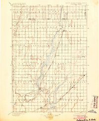
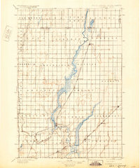
1896 Map of Columbia
USGS Topo · Published 1904About this map
The James River meanders through the heart of Brown County in this late-nineteenth-century survey, creating a broad wetland corridor that includes Sand Lake and Lake Columbia. This landscape is defined by the early expansion of the Dakota prairie, where a lattice of township boundaries like Liberty and Greenfield organize the flat terrain. The settlement at Columbia serves as a central hub near the confluence of the main river and the Elm River, while smaller rail-side villages such as Hecla, Houghton, and Claremont mark the progress of northern development. Multiple railroad lines, including the Huron and Oakes Line and the Aberdeen and Ellendale Line, cut diagonally across the survey grid, illustrating the vital role of steam transport in connecting these remote agricultural outposts to larger markets during the territorial transition.
Find a feature on this map
47 named features on this map. Tap any name to fly to it.
Don’t see what you’re looking for? This feature index may not catch every label — zoom into the map to look around manually.
Map Details
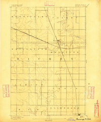
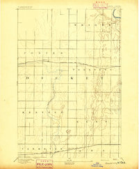
Editions of this 1896 Columbia Map
3 editions found
Other maps of this area
1894 · Monango
USGS Topo · 1:62,500

1894 · Ellendale
USGS Topo · 1:62,500

1894 · Hecla
USGS Topo · 1:62,500

1894 · Columbia
USGS Topo · 1:62,500

1894 · Savo
USGS Topo · 1:62,500
1894 · Fullerton
USGS Topo · 1:62,500

1894 · Oakes
USGS Topo · 1:62,500

1895 · Lamoure
USGS Topo · 1:125,000

1895 · Aberdeen
USGS Topo · 1:125,000

1896 · Columbia
USGS Topo · 1:125,000
Featured Places
- Aberdeen, Aberdeen Township
- Hecla, Hecla Township
- Ordway, Ordway Township
- Frederick, Frederick Township
- Columbia, Columbia Township