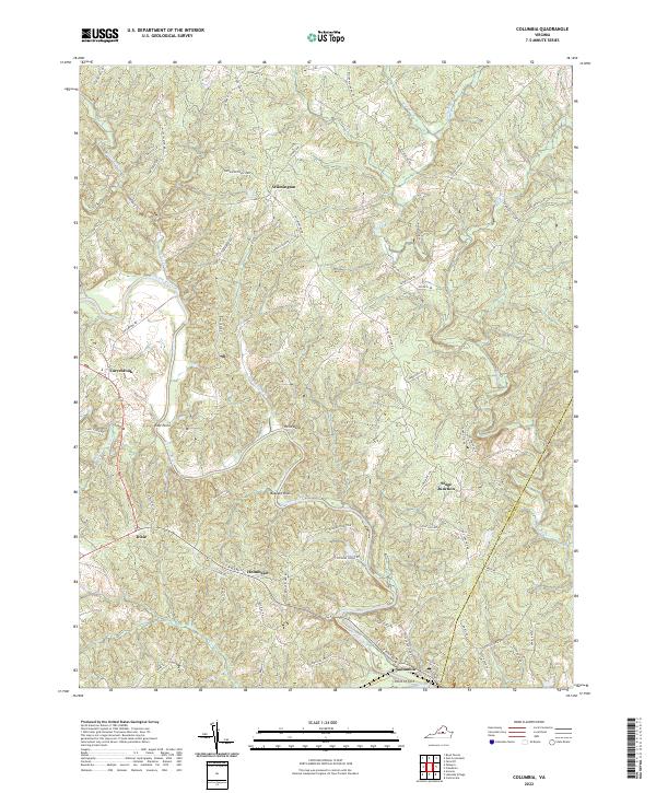
2022 Map of Columbia
USGS Topo · Published 2022About this map
The Rivanna River serves as the central artery for this central Virginia landscape, winding through a series of sharp meanders such as Hells Bend and Buzzard Rock. In the south, the river reaches Point of Fork near the town of Columbia, marking a historic confluence and transportation node. The map documents a predominantly rural settlement pattern, with small communities and named junctions like Wilmington, Stage Junction, and Holmhead connected by a network of winding local roads.
Find a feature on this map
72 named features on this map. Tap any name to fly to it.
Don’t see what you’re looking for? This feature index may not catch every label — zoom into the map to look around manually.
Map Details
Editions of this 2022 Columbia Map
This is the sole edition of this map. No revisions or reprints were ever made.
Other maps of this area

1891 · Palmyra
USGS Topo · 1:125,000

1895 · Palmyra
USGS Topo · 1:125,000

1897 · Palmyra
USGS Topo · 1:125,000

1943 · Scottsville
USGS Topo · 1:62,500

1946 · Scottsville
USGS Topo · 1:62,500

1947 · Roanoke
USGS Topo · 1:250,000

1950 · Dillwyn
USGS Topo · 1:62,500

1958 · Dillwyn
USGS Topo · 1:62,500

1959 · Roanoke
USGS Topo · 1:250,000

1960 · Columbia
USGS Topo · 1:62,500