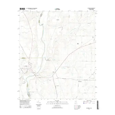
2014 Map of Columbia
USGS Topo · Published 2014About this map
The Chattahoochee River carves a winding path along the state line between Alabama and Georgia, anchoring a landscape defined by riverside settlements and crossing points. In the western portion of the map, the town of Columbia serves as a hub of activity with its street grid and industrial features, including Industrial Park Blvd and State Docks Rd. Nearby, the Columbia Bridge and the historic Coheelee Creek Covered Bridge provide essential passages across the waterways, reflecting the region's reliance on both modern and traditional infrastructure.
Find a feature on this map
74 named features on this map. Tap any name to fly to it.
Don’t see what you’re looking for? This feature index may not catch every label — zoom into the map to look around manually.
Map Details
Editions of this 2014 Columbia Map
This is the sole edition of this map. No revisions or reprints were ever made.
Other maps of this area

1953 · Dothan
USGS Topo · 1:250,000

1954 · Dothan
USGS Topo · 1:250,000

1955 · Dothan
USGS Topo · 1:250,000

1970 · Gordon
USGS Topo · 1:24,000

1970 · Columbia NE
USGS Topo · 1:24,000

1970 · Haleburg
USGS Topo · 1:24,000

1970 · Sigma
USGS Topo · 1:24,000

1970 · Columbia
USGS Topo · 1:24,000
1970 · Ashford
USGS Topo · 1:24,000

1973 · Blakely North
USGS Topo · 1:24,000