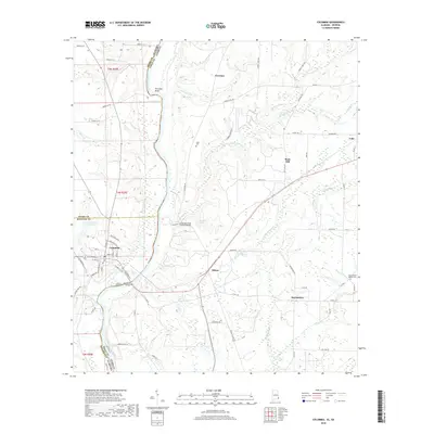
2018 Map of Columbia
USGS Topo · Published 2018About this map
The Chattahoochee River forms a prominent natural boundary between Houston and Henry Counties in Alabama and Early County, Georgia, defining the landscape of this 2018 survey. The town of Columbia serves as a focal point, situated near the Columbia Bridge and surrounded by a network of local roads including Industrial Blvd and Stillwater Rd. Moving east across the river into Georgia, the terrain features the notable Coheelee Creek Covered Bridge, a significant local landmark near the waters of Coheelee Cr. The map preserves the locations of rural settlements and community centers such as Hilton, Sawhatchee, and Rock Hill. Genealogists and local historians can locate several burial sites and places of worship, including the Zion Freewill Baptist Cem and Grier Cem. The geography is further characterized by numerous waterways like Omusee Creek, Sawhatchee Cr, and the distinctive Freeman Bend.
Find a feature on this map
78 named features on this map. Tap any name to fly to it.
Don’t see what you’re looking for? This feature index may not catch every label — zoom into the map to look around manually.
Map Details
Editions of this 2018 Columbia Map
This is the sole edition of this map. No revisions or reprints were ever made.
Other maps of this area

1953 · Dothan
USGS Topo · 1:250,000

1954 · Dothan
USGS Topo · 1:250,000

1955 · Dothan
USGS Topo · 1:250,000

1970 · Gordon
USGS Topo · 1:24,000

1970 · Columbia NE
USGS Topo · 1:24,000

1970 · Haleburg
USGS Topo · 1:24,000

1970 · Sigma
USGS Topo · 1:24,000

1970 · Columbia
USGS Topo · 1:24,000
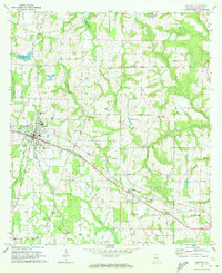
1970 · Ashford
USGS Topo · 1:24,000

1973 · Blakely North
USGS Topo · 1:24,000