
1970 Map of Columbia
USGS Topo · Published 1972About this map
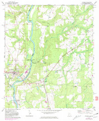
The Chattahoochee River defines the border between Alabama and Georgia in this 1970 snapshot, where the river-and-rail economy of the Wiregrass Region is on full display. The Central of Georgia railroad crosses the water just south of Columbia, connecting the town's industrial infrastructure, such as the Columbia State Dock and nearby gravel pits, to the wider region. To the south, the George W Andrews Lock and Dam underscores the importance of the river as a managed navigable waterway during this era.
Find a feature on this map
55 named features on this map. Tap any name to fly to it.
Don’t see what you’re looking for? This feature index may not catch every label — zoom into the map to look around manually.
Map Details
Editions of this 1970 Columbia Map
2 editions found
Other maps of this area

1953 · Dothan
USGS Topo · 1:250,000

1954 · Dothan
USGS Topo · 1:250,000

1955 · Dothan
USGS Topo · 1:250,000

1970 · Gordon
USGS Topo · 1:24,000

1970 · Columbia NE
USGS Topo · 1:24,000

1970 · Haleburg
USGS Topo · 1:24,000

1970 · Sigma
USGS Topo · 1:24,000
1970 · Ashford
USGS Topo · 1:24,000

1973 · Blakely North
USGS Topo · 1:24,000

1973 · Blakely South
USGS Topo · 1:24,000