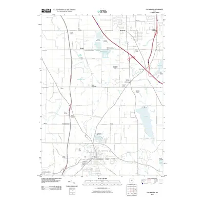
2010 Map of Columbiana
USGS Topo · Published 2010About this map
Columbiana and North Lima anchor this survey of northeast Ohio, where an extensive network of water resources and small-scale settlements defines the landscape. The region is notable for its numerous reservoirs and dams, including Pine Lake, Beaver Lake, and the Calvins Marsh Reservoir, which collectively suggest a history of sophisticated water management for both local recreation and utility. Local genealogists will find significant value in the high density of religious burial grounds, such as the Midway Mennonite Cemetery, Paradise Reformed Cemetery, and Paulin Cemetery, indicating a well-established community fabric rooted in several different denominations. Small hamlets like East Lewistown, Germantown, and Eureka are interspersed between larger transit hubs like the Youngstown-Elser Metro Airport, showing the mix of traditional rural crossroads and modern aviation infrastructure. The terrain is drained by numerous winding waterways, including the East Branch Middle Fork Little Beaver Creek and Yellow Creek, which carve through the townships between established roads like W Western Reserve Rd.
Find a feature on this map
99 named features on this map. Tap any name to fly to it.
Don’t see what you’re looking for? This feature index may not catch every label — zoom into the map to look around manually.
Map Details
Editions of this 2010 Columbiana Map
This is the sole edition of this map. No revisions or reprints were ever made.
Other maps of this area

1906 · Youngstown
USGS Topo · 1:62,500

1907 · Columbiana
USGS Topo · 1:62,500

1908 · Youngstown
USGS Topo · 1:62,500

1908 · Warren
USGS Topo · 1:62,500

1909 · Lisbon
USGS Topo · 1:62,500

1909 · Columbiana
USGS Topo · 1:62,500

1950 · Cleveland
USGS Topo · 1:250,000

1951 · Canton
USGS Topo · 1:250,000

1951 · Columbiana
USGS Topo · 1:24,000

1951 · Campbell
USGS Topo · 1:24,000