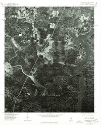
1975 Map of Columbiana SE
USGS Topo · Published 1977About this map
Shelby sits at the northern edge of this 1975 aerial survey, positioned among the hills of central Alabama. The landscape transitions from these upland forests down to the jagged, flooded inlets of the Coosa River, which dominates the eastern and southern portions of the map. Produced in cooperation with the Soil Conservation Service, this orthophotoquad provides an unfiltered photographic look at land use during the mid-seventies, showing a clear contrast between managed timberlands and the natural contours of the river valley. The dense network of wooded ridges and small clearings reflects the rural character of this region before significant modern development, preserving the exact footprint of the community and the winding shoreline of the river system as they existed decades ago.
Find a feature on this map
2 named features on this map. Tap any name to fly to it.
Don’t see what you’re looking for? This feature index may not catch every label — zoom into the map to look around manually.
Map Details
Editions of this 1975 Columbiana SE Map
This is the sole edition of this map. No revisions or reprints were ever made.
Other maps of this area

1890 · Bessemer
USGS Topo · 1:125,000

1890 · Talladega
USGS Topo · 1:125,000

1891 · Clanton
USGS Topo · 1:125,000

1892 · Talladega
USGS Topo · 1:125,000

1892 · Bessemer
USGS Topo · 1:125,000

1901 · Wetumpka
USGS Topo · 1:125,000

1903 · Wetumpka
USGS Topo · 1:125,000

1909 · Columbiana
USGS Topo · 1:62,500

1911 · Columbiana
USGS Topo · 1:62,500

1915 · Gantts Quarry
USGS Topo · 1:48,000