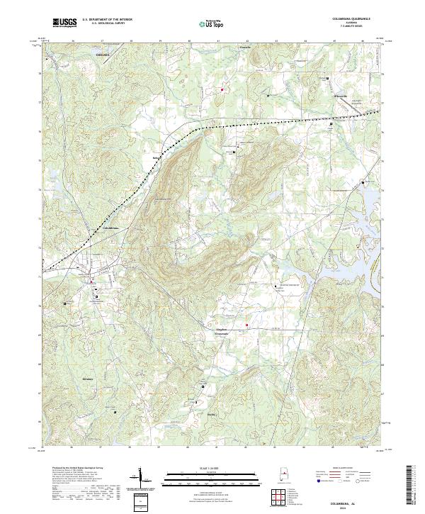
2024 Map of Columbiana
USGS Topo · Published 2024About this map
Columbiana serves as the focal point of this Shelby County landscape, with the historic Shelby County Courthouse marking the center of the local community. The terrain is defined by the prominent ridge of Columbiana Mtn, which separates the valley settlements. To the southeast, the waters of Lay Lake reach into the quadrangle via Little Beeswax Creek, creating a complex shoreline that interfaces with rural crossroads like Kingdom Crossroads.
Find a feature on this map
134 named features on this map. Tap any name to fly to it.
Don’t see what you’re looking for? This feature index may not catch every label — zoom into the map to look around manually.
Map Details
Editions of this 2024 Columbiana Map
This is the sole edition of this map. No revisions or reprints were ever made.
Other maps of this area

1890 · Bessemer
USGS Topo · 1:125,000

1890 · Talladega
USGS Topo · 1:125,000

1892 · Talladega
USGS Topo · 1:125,000

1892 · Bessemer
USGS Topo · 1:125,000

1906 · Vandiver
USGS Topo · 1:62,500

1908 · Vandiver
USGS Topo · 1:62,500

1909 · Columbiana
USGS Topo · 1:62,500

1911 · Columbiana
USGS Topo · 1:62,500

1915 · Gantts Quarry
USGS Topo · 1:48,000

1917 · Gantts Quarry
USGS Topo · 1:62,500