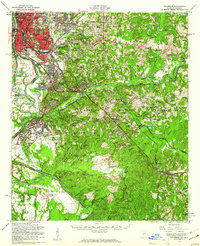
1955 Map of Columbus
USGS Topo · Published 1961About this map
The Chattahoochee River defines the western edge of this mid-century landscape, separating the growing urban grid of Columbus and Bibb City from the Alabama shoreline. To the south and east, the massive expanse of the Fort Benning Military Reservation dominates the topography, characterized by a complex network of hills named for individuals such as Montgomery Hill, Hutchcraft Hill, and Holiday Hill. The military presence is further marked by Lawson Field and the McBride Bridge over Upatoi Creek.
Find a feature on this map
134 named features on this map. Tap any name to fly to it.
Don’t see what you’re looking for? This feature index may not catch every label — zoom into the map to look around manually.
Map Details
Editions of this 1955 Columbus Map
This is the sole edition of this map. No revisions or reprints were ever made.
Other maps of this area

1907 · Talbotton
USGS Topo · 1:125,000

1907 · Opelika
USGS Topo · 1:125,000

1908 · Columbus
USGS Topo · 1:62,500

1909 · Opelika
USGS Topo · 1:125,000

1914 · Seale
USGS Topo · 1:62,500

1929 · Columbus
USGS Topo · 1:48,000

1947 · Columbus
USGS Topo · 1:62,500

1949 · Midland
USGS Topo · 1:24,000

1949 · Fort Mitchell
USGS Topo · 1:24,000

1949 · Glen Alta
USGS Topo · 1:24,000