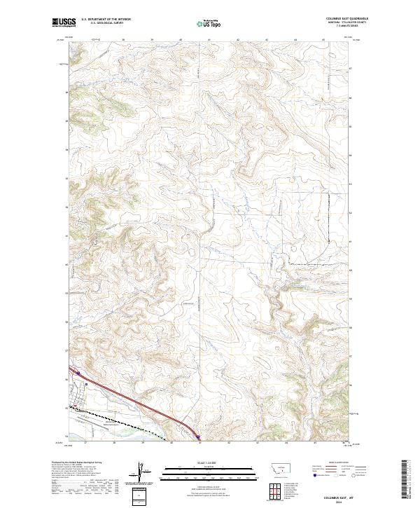
2024 Map of Columbus East
USGS Topo · Published 2024About this map
The town of Columbus anchors the southwestern corner of this Stillwater County landscape, situated where the high plains meet the intricate drainage systems of the Yellowstone valley. The area is defined by a series of parallel watercourses including Hensley Creek, Toms Creek, and Horse Creek, which carve through the rising elevation of Shaw Ridge. An important piece of agricultural infrastructure, the Columbus Water Users Association Ditch, follows the contour of the valley floor, illustrating the region's historical reliance on managed water for ranching and farming. Near the southern edge, the Woltermann Memorial Airport provides a modern navigational landmark adjacent to the older routes of Old US Hwy 10. The map also traces various local thoroughfares such as Sheep Dip Rd and Michigan Ridge Rd, which provide access to the high ground overlooking the drainage basins.
Find a feature on this map
32 named features on this map. Tap any name to fly to it.
Don’t see what you’re looking for? This feature index may not catch every label — zoom into the map to look around manually.
Map Details
Editions of this 2024 Columbus East Map
This is the sole edition of this map. No revisions or reprints were ever made.
Other maps of this area

1892 · Stillwater
USGS Topo · 1:125,000

1954 · Billings
USGS Topo · 1:250,000

1955 · Whitebird School
USGS Topo · 1:24,000

1956 · Columbus West
USGS Topo · 1:24,000

1956 · Hunter Lake
USGS Topo · 1:24,000

1956 · Shane Ridge
USGS Topo · 1:24,000

1956 · Horse Butte
USGS Topo · 1:24,000

1956 · Columbus East
USGS Topo · 1:24,000

1956 · Lindemulder Hill
USGS Topo · 1:24,000

1956 · Rapids
USGS Topo · 1:24,000