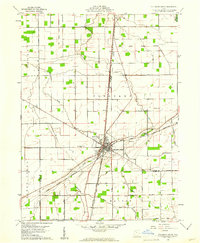
1960 Map of Columbus Grove
USGS Topo · Published 1961About this map
Columbus Grove serves as the central hub of this 1960 survey, situated at the junction of three major rail lines: the Baltimore and Ohio, the Detroit Toledo and Ironton, and the Akron Canton and Youngstown. The landscape is defined by the legacy of early land divisions, most notably the Old Indian Treaty Boundary which cuts diagonally across the northern townships.
Find a feature on this map
33 named features on this map. Tap any name to fly to it.
Don’t see what you’re looking for? This feature index may not catch every label — zoom into the map to look around manually.
Map Details
Editions of this 1960 Columbus Grove Map
2 editions found
Other maps of this area

1906 · Columbus Grove
USGS Topo · 1:62,500

1907 · Bluffton
USGS Topo · 1:62,500

1908 · Columbus Grove
USGS Topo · 1:62,500

1908 · Ottawa
USGS Topo · 1:62,500

1950 · Marion
USGS Topo · 1:250,000

1953 · Fort Wayne
USGS Topo · 1:250,000

1953 · Muncie
USGS Topo · 1:250,000

1956 · Muncie
USGS Topo · 1:250,000

1956 · Fort Wayne
USGS Topo · 1:250,000

1956 · Toledo
USGS Topo · 1:250,000