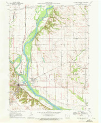
1970 Map of Columbus Junction
USGS Topo · Published 1972About this map
The confluence of the Cedar River and the Iowa River dominates this eastern Iowa landscape, creating a broad alluvial plain that historically shaped local settlement and transportation. Columbus Junction sits at this strategic watery junction, served by the Chicago Rock Island and Pacific railroad, which follows the river valleys. The survey captures a well-established rural infrastructure of the early 1970s, documented through numerous family and community landmarks such as Tennessee Cem and Cedar Bethel Ch.
Find a feature on this map
36 named features on this map. Tap any name to fly to it.
Don’t see what you’re looking for? This feature index may not catch every label — zoom into the map to look around manually.
Map Details
Editions of this 1970 Columbus Junction Map
This is the sole edition of this map. No revisions or reprints were ever made.
Other maps of this area

1946 · Wapello
USGS Topo · 1:62,500

1948 · Muscatine
USGS Topo · 1:62,500

1949 · Wapello
USGS Topo · 1:62,500

1958 · Davenport
USGS Topo · 1:250,000

1961 · Davenport
USGS Topo · 1:250,000

1962 · Davenport
USGS Topo · 1:250,000

1965 · Letts
USGS Topo · 1:24,000
1965 · Muscatine NW
USGS Topo · 1:24,000
1965 · Wapello
USGS Topo · 1:24,000
1969 · Lone Tree
USGS Topo · 1:24,000