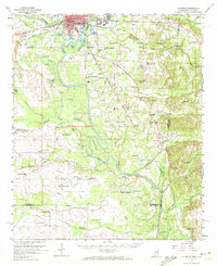
1960 Map of Columbus
USGS Topo · Published 1972About this map
The Tombigbee River anchors this mid-century portrait of northeastern Mississippi, where it winds through Lowndes County toward Hairston Bend. The city of Columbus is shown as a significant regional hub, anchored by the State College for Women and served by the St Louis San Francisco and Mobile and Ohio railroads. The map captures a landscape defined by water and aviation, featuring Lake Catherine and Bowlin Lake alongside the Columbus-Lowndes Co Airport and Vaughn Landing Field. In the rural hinterlands, a dense network of country schools and churches like Oak Grove Ch, Plum Grove Sch, and Union Hopewell Ch suggests the era's communal structure. Along the river, the Nashville Ferry remains a documented crossing point, and Camp Pratt sits tucked near the banks, reflecting the area's recreational and community life.
Find a feature on this map
83 named features on this map. Tap any name to fly to it.
Don’t see what you’re looking for? This feature index may not catch every label — zoom into the map to look around manually.
Map Details
Editions of this 1960 Columbus Map
2 editions found
Other maps of this area

1953 · West Point
USGS Topo · 1:250,000

1958 · West Point
USGS Topo · 1:250,000

1959 · Artesia
USGS Topo · 1:62,500

1959 · West Point
USGS Topo · 1:62,500

1960 · Caledonia
USGS Topo · 1:62,500

1960 · Columbus
USGS Topo · 1:62,500

1963 · West Point
USGS Topo · 1:250,000

1966 · Ethelsville
USGS Topo · 1:24,000

1966 · Reform SW
USGS Topo · 1:24,000

1967 · Fernbank
USGS Topo · 1:24,000