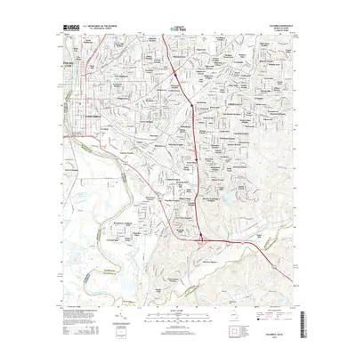
2014 Map of Columbus
USGS Topo · Published 2014About this map
Bibb City and the historic riverfront of Columbus define this portion of the Chattahoochee River corridor along the Georgia-Alabama border. The landscape is marked by a dense concentration of civic and memorial spaces, including the sprawling grounds of Linwood Cem, Porterdale Cem, and Riverdale Cem, which reflect the city's long-standing urban layout. The map traces the growth of numerous residential districts like Dinglewood, Weracoba Heights, and Hilton Heights, illustrating the mid-century suburban expansion that moved east and north from the city center.
Find a feature on this map
152 named features on this map. Tap any name to fly to it.
Don’t see what you’re looking for? This feature index may not catch every label — zoom into the map to look around manually.
Map Details
Editions of this 2014 Columbus Map
This is the sole edition of this map. No revisions or reprints were ever made.
Other maps of this area

1907 · Talbotton
USGS Topo · 1:125,000

1907 · Opelika
USGS Topo · 1:125,000

1908 · Columbus
USGS Topo · 1:62,500

1909 · Opelika
USGS Topo · 1:125,000

1914 · Seale
USGS Topo · 1:62,500

1929 · Columbus
USGS Topo · 1:48,000

1947 · Columbus
USGS Topo · 1:62,500

1949 · Midland
USGS Topo · 1:24,000

1949 · Fort Mitchell
USGS Topo · 1:24,000

1949 · Ochillee
USGS Topo · 1:24,000