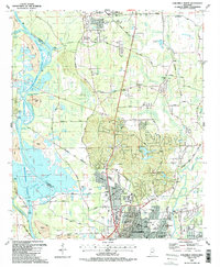
1987 Map of Columbus North
USGS Topo · Published 1987About this map
The Tennessee-Tombigbee Waterway and its complex system of cuts and locks dominate this 1987 landscape, reflecting the significant civil engineering projects that reshaped the Tombigbee River valley. To the north, the sprawling Columbus Air Force Base stands as a major regional anchor, while the city of Columbus expands to the south and east. This era shows a transition in local infrastructure, with the Columbus and Greenville Railway and the BN railroad lines navigating around new water features like Columbus Lake and the Columbus Lock and Dam.
Find a feature on this map
79 named features on this map. Tap any name to fly to it.
Don’t see what you’re looking for? This feature index may not catch every label — zoom into the map to look around manually.
Map Details
Editions of this 1987 Columbus North Map
2 editions found
Other maps of this area

1953 · West Point
USGS Topo · 1:250,000

1958 · West Point
USGS Topo · 1:250,000

1959 · Artesia
USGS Topo · 1:62,500

1959 · West Point
USGS Topo · 1:62,500

1960 · Caledonia
USGS Topo · 1:62,500

1960 · Columbus
USGS Topo · 1:62,500

1963 · West Point
USGS Topo · 1:250,000

1982 · West Point
USGS Topo · 1:100,000

1984 · West Point
USGS Topo · 1:250,000
1987 · Hamilton
USGS Topo · 1:24,000