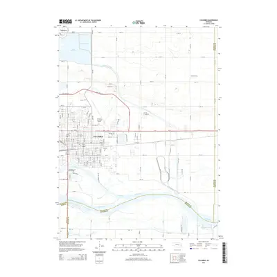
2014 Map of Columbus
USGS Topo · Published 2014About this map
Columbus serves as a major agricultural and transportation hub at the confluence of the Loup River and the Platte River. This survey captures the town's modern footprint, including the Columbus Municipal Airport and a dense residential grid that stretches toward Lakeview in the northwest. The surrounding landscape is defined by an intricate network of waterways and irrigation infrastructure, notably the Loup River Canal and Lake North. For genealogists and local historians, the map identifies several significant interment sites, such as the Columbus Cem, Catholic Cem, and Roselawn Cem. The southern portion of the quadrangle shows the river's braided channels, including the S Channel Platte River and the confluence with Clear Cr, illustrating the dynamic nature of the Nebraska plains hydrology and the engineering required to bridge these wide spans at the Columbus Loup River Bridge.
Find a feature on this map
79 named features on this map. Tap any name to fly to it.
Don’t see what you’re looking for? This feature index may not catch every label — zoom into the map to look around manually.
Map Details
Editions of this 2014 Columbus Map
This is the sole edition of this map. No revisions or reprints were ever made.
Other maps of this area

1899 · David City
USGS Topo · 1:125,000

1955 · Fremont
USGS Topo · 1:250,000

1957 · Fremont
USGS Topo · 1:250,000

1958 · Fremont
USGS Topo · 1:250,000

1958 · Duncan
USGS Topo · 1:24,000

1958 · Columbus SW
USGS Topo · 1:24,000

1958 · Columbus SE
USGS Topo · 1:24,000

1958 · Columbus
USGS Topo · 1:24,000

1966 · Clarkson SW
USGS Topo · 1:24,000

1966 · Platte Center
USGS Topo · 1:24,000
Featured Places
- Columbus, NE
- Carriage House Estates, Columbus
- Country Mobile Villa, NE
- Platte County, NE
- Butler County, NE