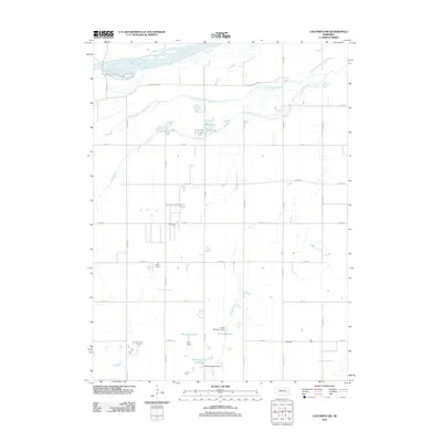
2011 Map of Columbus SW
USGS Topo · Published 2011About this map
The Platte River and its braided South Channel Platte River dominate the northern landscape of this Platte County region. This 2011 survey illustrates a highly structured agricultural grid, where a network of section roads like Co Road S and Co Road 41 divide the fertile plains. The management of local water resources is evident through a series of named earthen works and impoundments in the southern portion of the quadrangle, including the Scow Detention Dam and Messing-Scow Reservoir. These features, along with Perry Reservoir and its associated Perry Dam, highlight the importance of irrigation and flood control in maintaining the area's agricultural productivity. Clear Creek meanders through the central sections, providing a natural drainage contrast to the geometric precision of the county road system and the expansive river channels to the north.
Find a feature on this map
26 named features on this map. Tap any name to fly to it.
Don’t see what you’re looking for? This feature index may not catch every label — zoom into the map to look around manually.
Map Details
Editions of this 2011 Columbus SW Map
This is the sole edition of this map. No revisions or reprints were ever made.
Other maps of this area

1896 · Stromsburg
USGS Topo · 1:125,000

1899 · David City
USGS Topo · 1:125,000

1955 · Fremont
USGS Topo · 1:250,000

1957 · Fremont
USGS Topo · 1:250,000

1958 · Fremont
USGS Topo · 1:250,000

1958 · Monroe
USGS Topo · 1:24,000

1958 · Duncan
USGS Topo · 1:24,000

1958 · Columbus SW
USGS Topo · 1:24,000

1958 · Silver Creek SE
USGS Topo · 1:24,000

1958 · Columbus SE
USGS Topo · 1:24,000