
1907 Map of Colusa
USGS Topo · Published 1916About this map
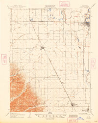
Colusa serves as the focal point for this early 20th-century survey of the Sacramento Valley, where the town layout is shown situated along a prominent bend in the river near Sabin Lake and Cobbs Bend. The map illustrates a landscape undergoing significant transformation through water management and rail expansion. The Southern Pacific (Woodland Line) bisects the territory diagonally, connecting the agricultural hubs of Williams and Arbuckle, while the Colusa and Lake railroad heads west from Colusa Junction. Extensive irrigation infrastructure, including the Cheney Slough and Irrigation Company Canal and Lurline Canal, highlights the shift toward systematic cultivation. Along the eastern edge, the Davis Levee and Old Davis Levee trace the historical efforts to control seasonal flooding from the sloughs and the river.
Find a feature on this map
34 named features on this map. Tap any name to fly to it.
Don’t see what you’re looking for? This feature index may not catch every label — zoom into the map to look around manually.
Map Details
Editions of this 1907 Colusa Map
3 editions found
Other maps of this area

1888 · Marysville
USGS Topo · 1:125,000

1891 · Marysville
USGS Topo · 1:125,000

1894 · Marysville
USGS Topo · 1:125,000

1895 · Marysville
USGS Topo · 1:125,000

1904 · Sites
USGS Topo · 1:24,000

1905 · Harrington
USGS Topo · 1:24,000

1905 · Fairview
USGS Topo · 1:24,000

1906 · Maxwell
USGS Topo · 1:62,500

1907 · Dunnigan
USGS Topo · 1:62,500

1907 · Colusa
USGS Topo · 1:62,500