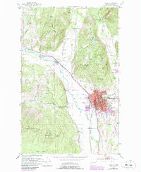
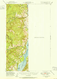
1952 Map of Colville
USGS Topo · Published 1986About this map
Colville serves as the regional hub in this mid-century landscape, positioned where the Colville River valley meets the rising slopes of Colville Mountain. The town layout includes essential civic infrastructure such as the Courthouse, City Hall, and several religious and educational sites like the Hofstetter School and Calvary Cemetery. Beyond the urban center, the map reveals the area's pioneer roots, specifically the Pinkney City Site and the Phipps Homestead, indicating the transition from early frontier outposts to a structured agricultural and timber economy.
Find a feature on this map
54 named features on this map. Tap any name to fly to it.
Don’t see what you’re looking for? This feature index may not catch every label — zoom into the map to look around manually.
Map Details
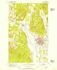
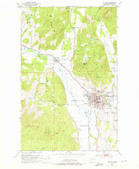
Editions of this 1952 Colville Map
3 editions found
Other maps of this area

1927 · Chewelah
USGS Topo · 1:125,000

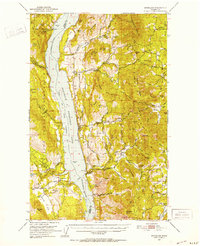
1929 · Colville
USGS Topo · 1:125,000

1930 · Chewelah
USGS Topo · 1:125,000

1933 · Colville
USGS Topo · 1:125,000

1936 · Marcus
USGS Topo · 1:96,000

1942 · Marcus
USGS Topo · 1:125,000

1948 · Kettle Falls
USGS Topo · 1:62,500
1950 · Inchelium
USGS Topo · 1:62,500
1951 · Kettle Falls
USGS Topo · 1:62,500
1952 · Gillette Mtn
USGS Topo · 1:24,000