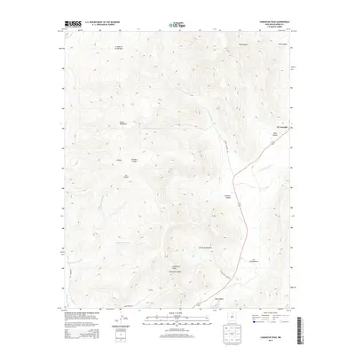
2013 Map of Comanche Peak
USGS Topo · Published 2013About this map
Comanche Peak serves as a prominent high point in this high-altitude landscape of northern New Mexico, overlooking the intricate drainages and canyon systems that define the region. The map details a traditional ranching and rural settlement pattern, with El Turquillo situated along the eastern slopes and Luceros located further south near the Mora Valley. The terrain is characterized by a series of named cañadas, such as Cañada de los Lovatos and La Cañada del Carro, which historically dictated the movement of livestock and travelers through the Rincon Mountains. These geographic features, including Solis Canyon and Trumbell Canyon, highlight the area's deep-rooted connection to the land and its Hispanic heritage, evidenced by the many Spanish-named land features like La Tierra Amarilla and El Poso.
Find a feature on this map
23 named features on this map. Tap any name to fly to it.
Don’t see what you’re looking for? This feature index may not catch every label — zoom into the map to look around manually.
Map Details
Editions of this 2013 Comanche Peak Map
This is the sole edition of this map. No revisions or reprints were ever made.
Other maps of this area

1889 · Las Vegas
USGS Topo · 1:125,000

1891 · Las Vegas
USGS Topo · 1:125,000

1893 · Las Vegas
USGS Topo · 1:125,000

1954 · Santa Fe
USGS Topo · 1:250,000

1954 · Raton
USGS Topo · 1:250,000

1958 · Raton
USGS Topo · 1:250,000

1958 · Santa Fe
USGS Topo · 1:250,000

1963 · Rainsville
USGS Topo · 1:24,000

1965 · Chacon
USGS Topo · 1:24,000

1965 · Holman
USGS Topo · 1:24,000