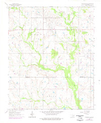
1964 Map of Comanche SE
USGS Topo · Published 1977About this map
Palacine Field and other petroleum developments dominate the landscape of southern Oklahoma during the mid-1960s. This survey records a transition zone where the industrial footprint of numerous oil wells, gas wells, and drill holes intermingles with rural landmarks like the Woolsey Cem. The topography is defined by the drainage networks of West Mud Creek and East Mud Creek, which converge as they flow south across the border between Stephens and Jefferson counties.
Find a feature on this map
16 named features on this map. Tap any name to fly to it.
Don’t see what you’re looking for? This feature index may not catch every label — zoom into the map to look around manually.
Map Details
Editions of this 1964 Comanche SE Map
2 editions found
Other maps of this area

1901 · Addington
USGS Topo · 1:125,000

1957 · Ardmore
USGS Topo · 1:250,000

1962 · Ryan
USGS Topo · 1:62,500

1963 · Ardmore
USGS Topo · 1:250,000

1963 · Harrisburg
USGS Topo · 1:24,000

1964 · Comanche SE
USGS Topo · 1:24,000

1964 · Duncan South
USGS Topo · 1:24,000

1964 · Comanche
USGS Topo · 1:24,000

1974 · Ringling NW
USGS Topo · 1:24,000

1974 · Loco
USGS Topo · 1:24,000