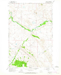
1961 Map of Comb Rock
USGS Topo · Published 1964About this map
The Dearborn River serves as the central artery of this Montana landscape, where the North Fork and Middle Fork converge to form the main channel. This 1961 field check documents a sparse network of mountain ranching life, characterized by family-named holdings such as the Ostle Ranch and Burggraff Ranch. Transportation across this Lewis and Clark County terrain is anchored by the Stearns - Wolf Creek Road, which traces the contours of the valley floor.
Find a feature on this map
29 named features on this map. Tap any name to fly to it.
Don’t see what you’re looking for? This feature index may not catch every label — zoom into the map to look around manually.
Map Details
Editions of this 1961 Comb Rock Map
3 editions found
Other maps of this area

1943 · Hogan
USGS Topo · 1:125,000

1955 · Choteau
USGS Topo · 1:250,000

1957 · Choteau
USGS Topo · 1:250,000

1958 · Choteau
USGS Topo · 1:250,000
1961 · Roberts Mountain
USGS Topo · 1:24,000
1961 · Wolf Creek
USGS Topo · 1:24,000
1961 · Coburn Mountain
USGS Topo · 1:24,000

1962 · Choteau
USGS Topo · 1:250,000
1962 · Bowmans Corners
USGS Topo · 1:24,000
1962 · Johnson Mountain
USGS Topo · 1:24,000