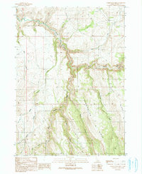
1990 Map of Combination Ridge
USGS Topo · Published 1991About this map
Combination Ridge dominates this Owyhee County landscape, forming a high, north-south divide that separates the drainage basins of several intricate stream systems. The topography is characterized by the convergence of steep canyons, most notably where Big Boulder Creek and North Boulder Creek meet. This 1990 provisional survey records a network of unimproved roads and a Pack Trail that follow the contours of the high desert terrain, suggesting a landscape primarily utilized for ranching or resource management rather than permanent settlement. The intricate web of named watercourses, including Indian Creek and Bogus Creek, highlights the importance of seasonal water in this high-elevation environment. The lack of schools, churches, or cemeteries indicates the remote nature of this portion of the Idaho backcountry during the late twentieth century.
Find a feature on this map
18 named features on this map. Tap any name to fly to it.
Don’t see what you’re looking for? This feature index may not catch every label — zoom into the map to look around manually.
Map Details
Editions of this 1990 Combination Ridge Map
This is the sole edition of this map. No revisions or reprints were ever made.
Other maps of this area

1955 · Jordan Valley
USGS Topo · 1:250,000

1957 · Jordan Valley
USGS Topo · 1:250,000

1958 · Jordan Valley
USGS Topo · 1:250,000

1965 · Triangle
USGS Topo · 1:62,500

1965 · Flint Creek
USGS Topo · 1:62,500

1973 · Indian Meadows
USGS Topo · 1:24,000

1973 · Wickiup Creek
USGS Topo · 1:24,000

1973 · Cliffs
USGS Topo · 1:24,000
1990 · Triangle
USGS Topo · 1:100,000
1990 · Triangle Flat
USGS Topo · 1:24,000