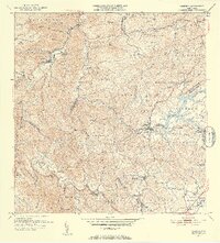
1953 Map of Comerio
USGS Topo · Published 1953About this map
Comerio and Cidra anchor this early 1950s survey of Puerto Rico's central mountain region, where the deep valleys of the Rio de la Plata and Río Bayamón define the landscape. The map captures an era of developing educational infrastructure, noting specialized facilities like the Escuela Superior de Comerio and several rural second-unit schools including the Escuela Segunda Unidad de Palomas. The reservoir of Lago de Cidra stands as a prominent geographic feature, surrounded by numerous named mountain peaks such as Cerro La Tiza and Cerro Santa Bárbara. The intricate network of winding roads and numerous 'Quebradas'—small streams like Quebrada Doña Elena and Quebrada Conventó—illustrate the complex topography that historically isolated these inland communities before modern transportation improvements.
Find a feature on this map
90 named features on this map. Tap any name to fly to it.
Don’t see what you’re looking for? This feature index may not catch every label — zoom into the map to look around manually.
Map Details
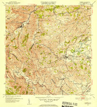
Editions of this 1953 Comerio Map
2 editions found
Other maps of this area

1946 · Patillas
USGS Topo · 1:30,000

1946 · Coamo
USGS Topo · 1:30,000

1946 · Aguas Buenas
USGS Topo · 1:30,000

1946 · Corozal
USGS Topo · 1:30,000

1946 · Barranquitas
USGS Topo · 1:30,000

1946 · Cayey
USGS Topo · 1:30,000

1946 · Comerio
USGS Topo · 1:30,000

1946 · Naranjito
USGS Topo · 1:30,000

1946 · Caguas
USGS Topo · 1:30,000

1947 · Cayey NO
USGS Topo · 1:10,000
Featured Places
- Cidra
- Comerío
- Sector Delfín "Fito" Cartagena Hernández, Aguas Buenas
- Sector Quebrada Adentro, Comerío
- Comunidad La Cumbre, Cidra