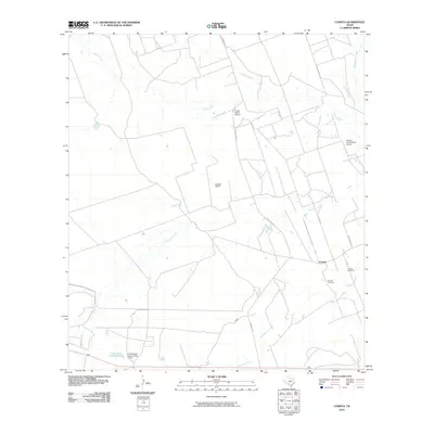
2010 Map of Cometa
USGS Topo · Published 2010About this map
Cometa sits as a central settlement in this south Texas landscape, characterized by large ranch holdings and a network of ephemeral waterways. The geography is defined by the drainage patterns of Comanche Creek, Pendencia Creek, and Chacon Creek, which cut through the brush country. Genealogy and local history are anchored by Cometa Cemetery and Vivian Cemetery, located near the junction of FM 393 and Rossington RD. The prominence of aviation in managing these large territories is evident through the inclusion of the Picosa Ranch Airport and Chacon Creek Ranch Airport. Private land use is further noted by sites like Eslabon Ranch and Farias Ranch Lake Number 1, reflecting the region's long-standing ranching tradition. This survey provides a clear view of the rural infrastructure in Zavala County, including the course of Ranch RD 2691 and various county roads that connect these isolated homesteads.
Find a feature on this map
20 named features on this map. Tap any name to fly to it.
Don’t see what you’re looking for? This feature index may not catch every label — zoom into the map to look around manually.
Map Details
Editions of this 2010 Cometa Map
This is the sole edition of this map. No revisions or reprints were ever made.
Other maps of this area

1939 · Carrizo Springs
USGS Topo · 1:62,500

1939 · La Pryor
USGS Topo · 1:62,500

1940 · Cometa
USGS Topo · 1:62,500

1940 · Chacon Creek
USGS Topo · 1:62,500

1953 · Crystal City
USGS Topo · 1:250,000

1955 · Crystal City
USGS Topo · 1:250,000

1958 · Eagle Pass
USGS Topo · 1:250,000

1961 · Crystal City
USGS Topo · 1:250,000

1965 · Eagle Pass
USGS Topo · 1:250,000

1968 · Crystal City
USGS Topo · 1:250,000