
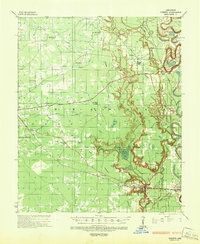
1935 Map of Cominto
USGS Topo · Published 1936About this map
The lowlands of Drew County and Lincoln County are defined by the winding course of Bartholomew Bayou and the intricate drainage of Cut-off Creek during the mid-1930s. This survey, conducted by the Corps of Engineers, reveals a landscape of small agricultural hubs and timber interests connected by the Missouri Pacific Railroad. Significant community landmarks include the Maben Mission and numerous combined rural institutions such as the Old Union Ch & Sch.
Find a feature on this map
51 named features on this map. Tap any name to fly to it.
Don’t see what you’re looking for? This feature index may not catch every label — zoom into the map to look around manually.
Map Details
Editions of this 1935 Cominto Map
3 editions found
Other maps of this area

1935 · Mist
USGS Topo · 1:62,500

1935 · Feenyville
USGS Topo · 1:62,500

1935 · Rotan
USGS Topo · 1:62,500

1935 · Red Fork
USGS Topo · 1:62,500

1936 · McGehee
USGS Topo · 1:62,500

1936 · Lake Village
USGS Topo · 1:62,500

1937 · McGehee
USGS Topo · 1:62,500

1953 · Greenwood
USGS Topo · 1:250,000

1955 · Lake Village
USGS Topo · 1:62,500

1955 · McGehee
USGS Topo · 1:62,500