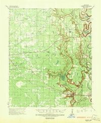
1935 Map of Cominto
USGS Topo · Published 1943About this map
The lowlands of Drew County are defined by the winding course of Bayou Bartholomew and the intricate drainage of Upper Cut-off Creek and Seven Devils Swamp. During the early 1930s, this region was a hub of timber activity, evidenced by the presence of an Abandoned Logging Railroad and an Abandoned Lumber Company Railroad cutting through the bottomlands near Collins and Baxter. The Missouri Pacific railroad serves as the primary transport spine, connecting the community of Cominto with neighboring settlements.
Find a feature on this map
58 named features on this map. Tap any name to fly to it.
Don’t see what you’re looking for? This feature index may not catch every label — zoom into the map to look around manually.
Map Details
Editions of this 1935 Cominto Map
3 editions found
Other maps of this area

1935 · Mist
USGS Topo · 1:62,500

1935 · Feenyville
USGS Topo · 1:62,500

1935 · Cominto
USGS Topo · 1:62,500

1935 · Rotan
USGS Topo · 1:62,500

1935 · Red Fork
USGS Topo · 1:62,500

1936 · McGehee
USGS Topo · 1:62,500

1936 · Lake Village
USGS Topo · 1:62,500

1937 · McGehee
USGS Topo · 1:62,500

1953 · Greenwood
USGS Topo · 1:250,000

1955 · Lake Village
USGS Topo · 1:62,500