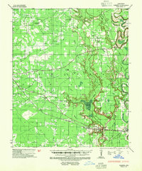
1935 Map of Cominto
USGS Topo · Published 1954About this map
Seven Devils Swamp dominates the central lowlands of this Drew County landscape, where the Piney escarpment marks a distinct shift in the eastern Arkansas terrain. The Missouri Pacific Railroad cuts a straight line through the southern portion of the territory, connecting the settlements of Deane, Cominto, Collins, Dukes, and Baxter. This rail corridor serves as the primary artery for a rural economy defined by scattered homesteads and community hubs.
Find a feature on this map
46 named features on this map. Tap any name to fly to it.
Don’t see what you’re looking for? This feature index may not catch every label — zoom into the map to look around manually.
Map Details
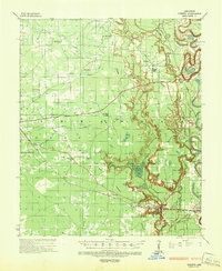
Editions of this 1935 Cominto Map
3 editions found
Other maps of this area

1935 · Mist
USGS Topo · 1:62,500

1935 · Feenyville
USGS Topo · 1:62,500

1935 · Cominto
USGS Topo · 1:62,500

1935 · Rotan
USGS Topo · 1:62,500

1935 · Red Fork
USGS Topo · 1:62,500

1936 · McGehee
USGS Topo · 1:62,500

1936 · Lake Village
USGS Topo · 1:62,500

1937 · McGehee
USGS Topo · 1:62,500

1953 · Greenwood
USGS Topo · 1:250,000

1955 · Lake Village
USGS Topo · 1:62,500