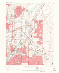
1965 Map of Commerce City
USGS Topo · Published 1967About this map
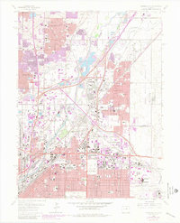
Industrial expansion and suburban growth define this mid-1960s landscape north of Denver, where the confluence of the South Platte River and Clear Creek meets a dense network of major rail lines. The map reveals the extensive industrial infrastructure of the era, from the sprawling Stapleton International Airport in the south to the Rocky Mountain Arsenal and various refineries. The concentration of meatpacking history is evident near the Denver Union Stockyards and Stockyard Arena, surrounded by worker neighborhoods like Welby and Dupont. Local life is further documented through numerous institutions, including the Clayton College for Boys and several parochial schools such as Holy Cross Sch and Annunciation High Sch. Rapid residential development is captured in the expanding street grids of Thornton and Commerce City, while historical burial grounds like Riverside Cemetery and Rose Hill Cemetery provide fixed points for genealogical research.
Find a feature on this map
88 named features on this map. Tap any name to fly to it.
Don’t see what you’re looking for? This feature index may not catch every label — zoom into the map to look around manually.
Map Details
Editions of this 1965 Commerce City Map
7 editions found
Other maps of this area

1890 · East Denver
USGS Topo · 1:125,000

1899 · West Denver
USGS Topo · 1:125,000

1935 · East Denver Nos. 3 and 4
USGS Topo · 1:48,000

1938 · Derby
USGS Topo · 1:24,000

1938 · Long Branch
USGS Topo · 1:24,000

1940 · Brighton
USGS Topo · 1:31,680

1940 · Englewood
USGS Topo · 1:31,680

1940 · Eastlake
USGS Topo · 1:31,680

1940 · Lafayette
USGS Topo · 1:31,680

1940 · Derby
USGS Topo · 1:31,680