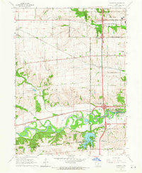
1965 Map of Commerce
USGS Topo · Published 1966About this map
The Raccoon River meanders through the heart of this landscape, marking a transition between the developing suburban fringes of Polk County and the agrarian fields of Dallas County. In the mid-1960s, this area was a critical transport corridor defined by the intersection of major rail lines and nascent interstate highway developments. The small settlement of Commerce sits near the river bend, while Waukee and Campbell anchor the northern reaches. The infrastructure of the era is evident in the sprawling rail networks of the Chicago Milwaukee St Paul and Pacific and the Chicago and North Western, which traverse the terrain alongside established thoroughfares like Hickman Road. Recreational and utility landmarks such as Walnut Woods State Park and the Dale Maffitt Reservoir provide a look at how public lands and water management shaped the local geography before suburban sprawl fully overtook the region.
Find a feature on this map
38 named features on this map. Tap any name to fly to it.
Don’t see what you’re looking for? This feature index may not catch every label — zoom into the map to look around manually.
Map Details
Editions of this 1965 Commerce Map
2 editions found
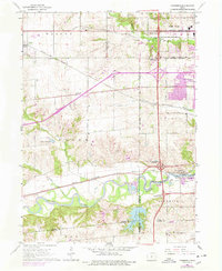
Other maps of this area

1905 · Des Moines
USGS Topo · 1:62,500

1907 · Des Moines
USGS Topo · 1:62,500

1908 · Waukee
USGS Topo · 1:62,500

1931 · Indianola
USGS Topo · 1:62,500

1951 · St. Charles
USGS Topo · 1:62,500

1954 · Des Moines
USGS Topo · 1:250,000

1956 · Des Moines
USGS Topo · 1:250,000

1956 · Des Moines NW
USGS Topo · 1:24,000

1956 · Des Moines SW
USGS Topo · 1:24,000

1956 · Des Moines
USGS Topo · 1:62,500