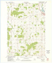
1975 Map of Como Creek
USGS Topo · Published 1978About this map
The town of Bloomer sits at the edge of Como Lake in this 1970s survey of Chippewa County, where agriculture and small rural crossroads define the landscape. The map highlights the intersection of several historic townships, including Bloomer, Auburn, and Cooks Valley, each marked by their local landmarks and cemeteries. Notable religious and community centers like St Johns Ch, St Johns Cem, and Cooks Valley Cem appear along the secondary roads, serving as vital markers for genealogical research in this part of Wisconsin.
Find a feature on this map
24 named features on this map. Tap any name to fly to it.
Don’t see what you’re looking for? This feature index may not catch every label — zoom into the map to look around manually.
Map Details
Editions of this 1975 Como Creek Map
This is the sole edition of this map. No revisions or reprints were ever made.
Other maps of this area

1934 · Elk Mound
USGS Topo · 1:62,500

1934 · Chippewa Falls
USGS Topo · 1:62,500

1936 · Chippewa Falls
USGS Topo · 1:62,500

1936 · Elk Mound
USGS Topo · 1:62,500

1949 · Bloomer
USGS Topo · 1:62,500

1949 · New Auburn
USGS Topo · 1:62,500

1951 · Bloomer
USGS Topo · 1:62,500

1951 · New Auburn
USGS Topo · 1:62,500

1953 · Eau Claire
USGS Topo · 1:250,000

1953 · Rice Lake
USGS Topo · 1:250,000