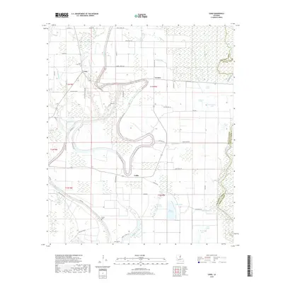
2018 Map of Como
USGS Topo · Published 2018About this map
Bayou Macon snakes through this alluvial landscape, defining the western edge of a region characterized by complex water systems and family-held agricultural lands. The small settlements of Como, Lorelein, and Griffin serve as anchors within this rural expanse, connected by a network of roads that often bear the names of local inhabitants, such as Wardell Reeves Rd and Frank Eckard Rd. The geography is defined by its depressions and brakes, including Wileys Brake and Snyder Brake, which suggest the historic flood patterns of the nearby Tensas River along the eastern parish boundary.
Find a feature on this map
61 named features on this map. Tap any name to fly to it.
Don’t see what you’re looking for? This feature index may not catch every label — zoom into the map to look around manually.
Map Details
Editions of this 2018 Como Map
This is the sole edition of this map. No revisions or reprints were ever made.
Other maps of this area

1935 · Winnsboro
USGS Topo · 1:62,500

1935 · Shackleford Lake
USGS Topo · 1:62,500

1939 · Locust Ridge
USGS Topo · 1:62,500

1941 · Sicily Island
USGS Topo · 1:62,500

1953 · Natchez
USGS Topo · 1:250,000

1955 · Jackson
USGS Topo · 1:250,000

1956 · Natchez
USGS Topo · 1:250,000

1957 · Sicily Island
USGS Topo · 1:62,500

1958 · Shackleford Lake
USGS Topo · 1:62,500

1958 · Winnsboro
USGS Topo · 1:62,500