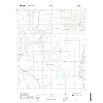
2020 Map of Como
USGS Topo · Published 2020About this map
Bayou Macon and the Tensas River define the fertile bottomlands of this region along the Franklin and Tensas Parish line. Small rural settlements like Como, Lorelein, and Griffin anchor the agricultural landscape, which is crisscrossed by a network of drainage ways including Wards Bayou, Long Bayou, and Sandy Bayou. The map reveals a land heavily shaped by water and tradition, where numerous brakes and lakes—such as Snyder Brake, Wileys Brake, Board Tree Lake, and Middle Lake—pockmark the terrain between cultivated fields. For those tracing local family history, several burial grounds are documented, including Ward Cem, Eureka Cem, and the State Place Cem. The road network, featuring names like Wardell Reeves Rd and Frank Eckard Rd, reflects the deep-rooted personal and family connections that characterize this Mississippi Delta landscape.
Find a feature on this map
66 named features on this map. Tap any name to fly to it.
Don’t see what you’re looking for? This feature index may not catch every label — zoom into the map to look around manually.
Map Details
Editions of this 2020 Como Map
This is the sole edition of this map. No revisions or reprints were ever made.
Other maps of this area

1935 · Winnsboro
USGS Topo · 1:62,500

1935 · Shackleford Lake
USGS Topo · 1:62,500

1939 · Locust Ridge
USGS Topo · 1:62,500

1941 · Sicily Island
USGS Topo · 1:62,500

1953 · Natchez
USGS Topo · 1:250,000

1955 · Jackson
USGS Topo · 1:250,000

1956 · Natchez
USGS Topo · 1:250,000

1957 · Sicily Island
USGS Topo · 1:62,500

1958 · Shackleford Lake
USGS Topo · 1:62,500

1958 · Winnsboro
USGS Topo · 1:62,500