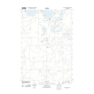
2011 Map of Comstock Hills
USGS Topo · Published 2011About this map
Comstock Hills rise over a landscape defined by glacial lakes and a complex network of seasonal recreational sites in the northern Michigan woods. The area around East Twin Lake and West Twin Lake serves as a significant hub for mid-century resort culture, evidenced by clusters of lakeside lodging such as Birdhaven Resort, Murrays Cabins, and Organs Log Cabins. This 2011 survey captures the transition from traditional woodsy retreats to more formal amenities, such as the expansive golf grounds of the Garland Village area.
Find a feature on this map
94 named features on this map. Tap any name to fly to it.
Don’t see what you’re looking for? This feature index may not catch every label — zoom into the map to look around manually.
Map Details
Editions of this 2011 Comstock Hills Map
This is the sole edition of this map. No revisions or reprints were ever made.
Other maps of this area

1949 · Lewiston
USGS Topo · 1:62,500

1950 · Lewiston
USGS Topo · 1:24,000

1950 · Comstock Hills
USGS Topo · 1:24,000

1950 · Johannesburg
USGS Topo · 1:24,000

1950 · Lovells
USGS Topo · 1:24,000

1951 · Comstock Hills
USGS Topo · 1:24,000

1951 · Lovells
USGS Topo · 1:24,000

1951 · Johannesburg
USGS Topo · 1:24,000

1951 · Lewiston
USGS Topo · 1:24,000

1954 · Traverse City
USGS Topo · 1:250,000
Featured Places
- Albert Township, MI
- Lovells Township, MI
- Elmer Township, MI
- Charlton Township, MI
- Greenwood Township, MI