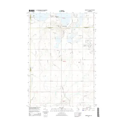
2014 Map of Comstock Hills
USGS Topo · Published 2014About this map
Lewiston anchors the northwest corner of this northern Michigan landscape, where the waters of West Twin Lake and East Twin Lake meet the edge of the Albert Township forest. The terrain is characterized by a dense network of glacial kettle lakes and creek systems, including Snyder Lake, Tea Lake, and the extensive wetlands surrounding Middle Br Big Cr. This 2014 representation shows the established recreational and residential character of Birchwood Beach and Garland Village, with the Garland Airport serving as a local transportation node. The map tracks the convergence of four counties—Otsego, Montmorency, Crawford, and Oscoda—illustrating how local roads like Williams Rd and Farrington Rd navigate the hilly topography of the Comstock Hills. Many smaller, secluded water bodies such as Moon Lake and Elmer Lake dot the eastern sections, reflecting the area's long-standing appeal for seasonal residency and outdoor recreation.
Find a feature on this map
44 named features on this map. Tap any name to fly to it.
Don’t see what you’re looking for? This feature index may not catch every label — zoom into the map to look around manually.
Map Details
Editions of this 2014 Comstock Hills Map
This is the sole edition of this map. No revisions or reprints were ever made.
Other maps of this area

1949 · Lewiston
USGS Topo · 1:62,500

1950 · Lewiston
USGS Topo · 1:24,000

1950 · Comstock Hills
USGS Topo · 1:24,000

1950 · Johannesburg
USGS Topo · 1:24,000

1950 · Lovells
USGS Topo · 1:24,000

1951 · Comstock Hills
USGS Topo · 1:24,000

1951 · Lovells
USGS Topo · 1:24,000

1951 · Johannesburg
USGS Topo · 1:24,000

1951 · Lewiston
USGS Topo · 1:24,000

1954 · Traverse City
USGS Topo · 1:250,000
Featured Places
- Albert Township, MI
- Lovells Township, MI
- Elmer Township, MI
- Charlton Township, MI
- Greenwood Township, MI