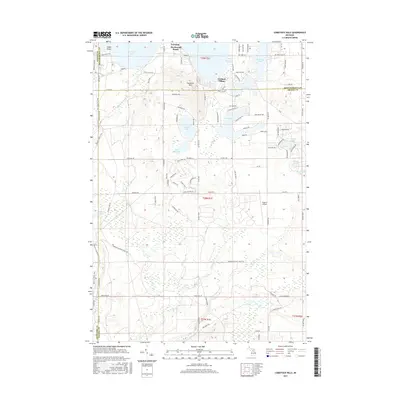
2017 Map of Comstock Hills
USGS Topo · Published 2017About this map
Lewiston Birchwood Beach sits along the northern edge of this northern Michigan landscape, where the glacial geography of Montmorency County is defined by a dense concentration of kettle lakes and wandering stream branches. The terrain rises into the Comstock Hills, a prominent upland area surrounded by water bodies including Snyder Lake, Tea Lake, and the expansive W Twin Lake. This network of water is further connected by the headwaters of the Middle Br Big Cr and E Br Big Cr, illustrating the complex local hydrology.
Find a feature on this map
109 named features on this map. Tap any name to fly to it.
Don’t see what you’re looking for? This feature index may not catch every label — zoom into the map to look around manually.
Map Details
Editions of this 2017 Comstock Hills Map
This is the sole edition of this map. No revisions or reprints were ever made.
Other maps of this area

1949 · Lewiston
USGS Topo · 1:62,500

1950 · Lewiston
USGS Topo · 1:24,000

1950 · Comstock Hills
USGS Topo · 1:24,000

1950 · Johannesburg
USGS Topo · 1:24,000

1950 · Lovells
USGS Topo · 1:24,000

1951 · Comstock Hills
USGS Topo · 1:24,000

1951 · Lovells
USGS Topo · 1:24,000

1951 · Johannesburg
USGS Topo · 1:24,000

1951 · Lewiston
USGS Topo · 1:24,000

1954 · Traverse City
USGS Topo · 1:250,000
Featured Places
- Albert Township, MI
- Lovells Township, MI
- Elmer Township, MI
- Charlton Township, MI
- Greenwood Township, MI