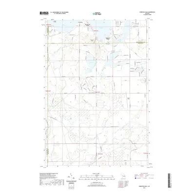
2019 Map of Comstock Hills
USGS Topo · Published 2019About this map
Lewiston and the neighboring settlements of Birchwood Beach and Garland Village anchor the northern reaches of this northern Michigan landscape. Set within the glacial topography of the Comstock Hills, the area is defined by a dense network of kettle lakes, including the large West Twin Lake and East Twin Lake, which have long driven the regional character of Albert Township. The 2019 data reveals a transition from these established lakeside communities into the more remote, marshy terrain to the south, where the headwaters of the E Br Big Cr and Middle Br Big Cr begin their course. Notable for its aviation and recreational infrastructure, the map shows Eagle II Airport situated between Tea Lake and the wetlands surrounding Wright Cr. This modern survey provides a detailed view of the road network, from named residential drives like Old Co Rd 612 to the trail systems that wind through the surrounding timber and wetlands.
Find a feature on this map
113 named features on this map. Tap any name to fly to it.
Don’t see what you’re looking for? This feature index may not catch every label — zoom into the map to look around manually.
Map Details
Editions of this 2019 Comstock Hills Map
This is the sole edition of this map. No revisions or reprints were ever made.
Other maps of this area

1949 · Lewiston
USGS Topo · 1:62,500

1950 · Lewiston
USGS Topo · 1:24,000

1950 · Comstock Hills
USGS Topo · 1:24,000

1950 · Johannesburg
USGS Topo · 1:24,000

1950 · Lovells
USGS Topo · 1:24,000

1951 · Comstock Hills
USGS Topo · 1:24,000

1951 · Lovells
USGS Topo · 1:24,000

1951 · Johannesburg
USGS Topo · 1:24,000

1951 · Lewiston
USGS Topo · 1:24,000

1954 · Traverse City
USGS Topo · 1:250,000
Featured Places
- Albert Township, MI
- Lovells Township, MI
- Elmer Township, MI
- Charlton Township, MI
- Greenwood Township, MI