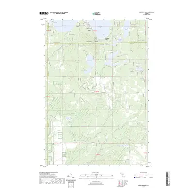
2023 Map of Comstock Hills
USGS Topo · Published 2023About this map
The Kirtlands Warbler Wildlife Management Area dominates much of the southern and central landscape, reflecting a specialized habitat managed across the intersection of Oscoda and Montmorency counties. This 2023 survey documents a region defined by its diverse glacial hydrology, where major water bodies like West Twin Lake and East Twin Lake are surrounded by residential pockets such as Birchwood Beach. To the south, the terrain transitions into a more intricate network of waterways, including Middle Branch Big Creek and Wright Creek, which carve through the plains.
Find a feature on this map
107 named features on this map. Tap any name to fly to it.
Don’t see what you’re looking for? This feature index may not catch every label — zoom into the map to look around manually.
Map Details
Editions of this 2023 Comstock Hills Map
This is the sole edition of this map. No revisions or reprints were ever made.
Other maps of this area

1949 · Lewiston
USGS Topo · 1:62,500

1950 · Lewiston
USGS Topo · 1:24,000

1950 · Comstock Hills
USGS Topo · 1:24,000

1950 · Johannesburg
USGS Topo · 1:24,000

1950 · Lovells
USGS Topo · 1:24,000

1951 · Comstock Hills
USGS Topo · 1:24,000

1951 · Lovells
USGS Topo · 1:24,000

1951 · Johannesburg
USGS Topo · 1:24,000

1951 · Lewiston
USGS Topo · 1:24,000

1954 · Traverse City
USGS Topo · 1:250,000
Featured Places
- Greenwood Township, MI
- Charlton Township, MI
- Birchwood Beach, MI
- Garland Village, MI
- Albert Township, MI