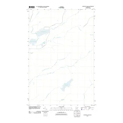
2010 Map of Comstock Lake
USGS Topo · Published 2010About this map
Whiteface River and the Us-Kab-Wan-Ka River define the hydrography of this northern Minnesota landscape, creating a complex network of waterways and glacial lakes. Centered on Comstock Lake and its smaller counterpart, Lower Comstock Lake, the region is characterized by thick drainage systems including Bug Creek and the meandering West Branch Bug Creek. These waters, alongside Rush Lake and Berle Lake, indicate a classic Northwoods wilderness profile where water transport and timber access likely historically shaped local activity. Access to these remote reaches is maintained via a sparse network of forest routes, most notably N Comstock Lake Rd and the Jim Readdy Forest Rd, which pierce the interior to reach isolated shorelines like those of Hart Lake and Hendrickson Lake.
Find a feature on this map
20 named features on this map. Tap any name to fly to it.
Don’t see what you’re looking for? This feature index may not catch every label — zoom into the map to look around manually.
Map Details
Editions of this 2010 Comstock Lake Map
This is the sole edition of this map. No revisions or reprints were ever made.
Other maps of this area

1951 · Makinen
USGS Topo · 1:24,000

1953 · Shaw
USGS Topo · 1:24,000

1953 · Boulder Lake Reservoir
USGS Topo · 1:24,000

1954 · Thompson Lake
USGS Topo · 1:24,000

1954 · Hibbing
USGS Topo · 1:250,000

1956 · Whiteface
USGS Topo · 1:24,000

1957 · Hibbing
USGS Topo · 1:250,000

1957 · Markham
USGS Topo · 1:62,500

1957 · Comstock Lake
USGS Topo · 1:24,000
1957 · Boulder Lake Reservoir NE
USGS Topo · 1:24,000