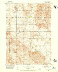
1952 Map of Comstock SE
USGS Topo · Published 1954About this map
One-room schools and section-line roads define this rural landscape in the early 1950s, a period when the U.S. Bureau of Reclamation was actively mapping the region for the development of the Missouri River Basin. The township boundaries of Geranium, Michigan, Liberty, and Vinton partition a terrain of intricate drainage patterns, with the South Branch Turtle Creek and Dane Creek carving deep into the hillsides. The density of educational landmarks, including Geranium Sch, Highland Sch, and the uniquely named Hardscrabble Sch, provides a detailed look at the localized social infrastructure of rural Valley County before the widespread consolidation of school districts. Scattered windmills and isolated farmsteads are linked by a network of unimproved dirt roads, while Hawthorne Creek flows through the southern reaches of the quadrangle.
Find a feature on this map
15 named features on this map. Tap any name to fly to it.
Don’t see what you’re looking for? This feature index may not catch every label — zoom into the map to look around manually.
Map Details
Editions of this 1952 Comstock SE Map
2 editions found
Other maps of this area

1899 · Loup
USGS Topo · 1:125,000

1951 · Arcadia West
USGS Topo · 1:24,000

1951 · Arcadia East
USGS Topo · 1:24,000

1952 · Elyria
USGS Topo · 1:24,000

1952 · Comstock
USGS Topo · 1:24,000

1952 · Comstock NW
USGS Topo · 1:24,000

1952 · Comstock SE
USGS Topo · 1:24,000

1953 · Loup City NW
USGS Topo · 1:24,000

1954 · Ord
USGS Topo · 1:24,000

1954 · Ord NW
USGS Topo · 1:24,000