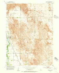
1952 Map of Comstock
USGS Topo · Published 1954About this map
The Middle Loup River valley anchors this mid-century survey of the border between Custer and Valley counties. The village of Comstock sits prominently along the Chicago Burlington and Quincy railroad line, serving as the local hub for a landscape defined by organized rural districts such as Douglas Grove and Geranium. This period is marked by the shifting nature of rural education, as shown by the labeling of both active and inactive sites like School No 10 and Lone Star Sch (Abandoned).
Find a feature on this map
20 named features on this map. Tap any name to fly to it.
Don’t see what you’re looking for? This feature index may not catch every label — zoom into the map to look around manually.
Map Details
Editions of this 1952 Comstock Map
3 editions found
Other maps of this area

1951 · Ansley NE
USGS Topo · 1:24,000

1951 · Arcadia West
USGS Topo · 1:24,000

1951 · Arcadia East
USGS Topo · 1:24,000

1952 · Sargent East
USGS Topo · 1:24,000

1952 · Elyria
USGS Topo · 1:24,000

1952 · Sargent SE
USGS Topo · 1:24,000

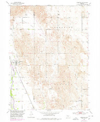
1952 · Comstock
USGS Topo · 1:24,000

1952 · Comstock NW
USGS Topo · 1:24,000

1952 · Comstock SE
USGS Topo · 1:24,000

1955 · Broken Bow
USGS Topo · 1:250,000