
1952 Map of Conata NE
USGS Topo · Published 1952About this map
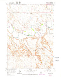
Badlands National Monument and the northern reaches of the Pine Ridge Indian Reservation meet along the winding course of the White River in this 1952 survey. The landscape is defined by the sharp transition from the level plateau and the erosional features of Castle Butte to the river valley floor. A shared National Monument Boundary and Reservation Boundary underscores the complex land management of the era.
Find a feature on this map
18 named features on this map. Tap any name to fly to it.
Don’t see what you’re looking for? This feature index may not catch every label — zoom into the map to look around manually.
Map Details
Editions of this 1952 Conata NE Map
2 editions found
Other maps of this area

1950 · Conata
USGS Topo · 1:24,000

1950 · Interior
USGS Topo · 1:24,000

1950 · Conata SW
USGS Topo · 1:24,000

1950 · Potato Creek
USGS Topo · 1:24,000

1952 · Conata SE
USGS Topo · 1:24,000

1952 · Conata
USGS Topo · 1:24,000

1955 · Hot Springs
USGS Topo · 1:250,000

1955 · Martin
USGS Topo · 1:250,000

1958 · Martin
USGS Topo · 1:250,000

1960 · Wall SE
USGS Topo · 1:24,000