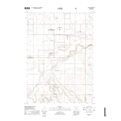
2017 Map of Conata
USGS Topo · Published 2017About this map
Buffalo Gap National Grassland dominates this western South Dakota landscape, where the high prairie meets the intricate drainage systems of the Badlands region. The small settlement of Conata sits near the northern boundary, served by Sn 44 and 193rd Ave. This area is defined by the significant hydrological influence of the White River, which meanders across the central portion of the map, fed by tributaries like Redwater Cr. High points such as Hurley Butte and Keller Butte provide topographical orientation in a territory that spans the borders of Pennington, Jackson, and Oglala Lakota counties. The map captures the specialized land use patterns of the Great Plains, illustrating the vast open spaces preserved within the Buffalo Gap NG and the sparsely populated ranching and agricultural tracts that surround it.
Find a feature on this map
20 named features on this map. Tap any name to fly to it.
Don’t see what you’re looking for? This feature index may not catch every label — zoom into the map to look around manually.
Map Details
Editions of this 2017 Conata Map
This is the sole edition of this map. No revisions or reprints were ever made.
Other maps of this area

1950 · Conata
USGS Topo · 1:24,000

1950 · Conata SW
USGS Topo · 1:24,000

1950 · Imlay SE
USGS Topo · 1:24,000

1950 · Bouquet Table
USGS Topo · 1:24,000

1952 · Conata NE
USGS Topo · 1:24,000

1952 · Bouquet Table
USGS Topo · 1:24,000

1952 · Conata SE
USGS Topo · 1:24,000

1952 · Conata
USGS Topo · 1:24,000

1955 · Hot Springs
USGS Topo · 1:250,000

1960 · Wall SE
USGS Topo · 1:24,000