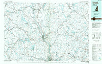
1986 Map of Concord
USGS Topo · Published 1986About this map
The Merrimack River serves as the central corridor for this 1980s landscape, connecting the capital city of Concord with the northern industrial reaches of Manchester. The settlement pattern reflects a mix of growing urban centers and smaller, traditional villages like Gilmanton Ironworks, New Durham Corner, and Middleton Corners. This planimetric study documents the mid-century transportation infrastructure, showing the established routes of Interstate 93 and Interstate 89 alongside the historic Boston and Maine Railroad lines that once dominated local commerce.
Find a feature on this map
118 named features on this map. Tap any name to fly to it.
Don’t see what you’re looking for? This feature index may not catch every label — zoom into the map to look around manually.
Map Details
Editions of this 1986 Concord Map
This is the sole edition of this map. No revisions or reprints were ever made.
Other maps of this area

1888 · Newburyport
USGS Topo · 1:62,500

1888 · Haverhill
USGS Topo · 1:62,500

1890 · Haverhill
USGS Topo · 1:62,500

1890 · Newburyport
USGS Topo · 1:62,500

1891 · Berwick
USGS Topo · 1:62,500

1891 · Newfield
USGS Topo · 1:62,500

1893 · Dover
USGS Topo · 1:62,500

1893 · Berwick
USGS Topo · 1:62,500

1893 · Newfield
USGS Topo · 1:62,500

1893 · Haverhill
USGS Topo · 1:62,500