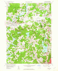
1958 Map of Concord
USGS Topo · Published 1963About this map
The town of Concord and its surroundings appear as a landscape preserved in its literary and revolutionary history, even as mid-century infrastructure begins to reshape the region. The map meticulously charts the burial grounds and scholarly institutions central to the area's identity, from Sleepy Hollow Cemetery and the Old Burying Ground to Concord Academy and the Middlesex Sch. This 1958 revision captures the area before modern suburbanization fully took hold, preserving the relationship between the Concord River and the small-scale agricultural lots that still dominated the western portion of the quadrangle.
Find a feature on this map
124 named features on this map. Tap any name to fly to it.
Don’t see what you’re looking for? This feature index may not catch every label — zoom into the map to look around manually.
Map Details
Editions of this 1958 Concord Map
3 editions found
Other maps of this area

1886 · Lawrence
USGS Topo · 1:62,500

1886 · Lowell
USGS Topo · 1:62,500

1886 · Framingham
USGS Topo · 1:62,500

1888 · Lawrence
USGS Topo · 1:62,500

1889 · Framingham
USGS Topo · 1:62,500

1893 · Lowell
USGS Topo · 1:62,500

1893 · Boston
USGS Topo · 1:62,500

1893 · Lawrence
USGS Topo · 1:62,500

1894 · Framingham
USGS Topo · 1:62,500

1903 · Boston
USGS Topo · 1:62,500