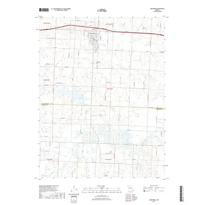
2017 Map of Concordia
USGS Topo · Published 2017About this map
Concordia serves as the primary hub of this landscape, situated along the northern edge where established residential streets like S Main St and S Orange St meet the regional transport corridor of Old Hwy 40. This 2017 survey reveals a complex hydrological network defined by the Blackwater River and its numerous tributaries, including Panther Cr and Walnut Cr. The topography is marked by significant water features such as Edwin A Pape Lake and Horseshoe Lake, which influence the local drainage patterns south of town.
Find a feature on this map
81 named features on this map. Tap any name to fly to it.
Don’t see what you’re looking for? This feature index may not catch every label — zoom into the map to look around manually.
Map Details
Editions of this 2017 Concordia Map
This is the sole edition of this map. No revisions or reprints were ever made.
Other maps of this area

1885 · Warrensburg
USGS Topo · 1:125,000

1887 · Sedalia
USGS Topo · 1:125,000

1887 · Warrensburg
USGS Topo · 1:125,000

1889 · Lexington
USGS Topo · 1:125,000

1890 · Marshall
USGS Topo · 1:125,000

1892 · Marshall
USGS Topo · 1:125,000

1894 · Sedalia
USGS Topo · 1:125,000

1894 · Warrensburg
USGS Topo · 1:125,000

1901 · Marshall
USGS Topo · 1:125,000

1917 · Knobnoster
USGS Topo · 1:62,500