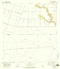
1969 Map of Concordia
USGS Topo · Published 1977About this map
Petronila Creek meanders through the northeast corner of this coastal prairie landscape, carving deep relief into an otherwise level plain on the border of Nueces and Kleberg Counties. The 1969 field-checked data shows a region defined by large-scale ranching and petroleum extraction, with scattered Oil Wells and a network of named landmarks essential for cattle operations. Settlements are sparse, centered on small hubs like Concordia and the nearby St Paul Cem. The southern half of the map reveals a distinct lack of traditional roads, replaced by a grid of named water sources such as Mota Redonda Windmill, Noria Honda Windmill, and Palma Windmill. These features, alongside extensive fence lines, reflect the specialized land use of the South Texas brush country before modern suburban expansion reached this far south of Corpus Christi.
Find a feature on this map
18 named features on this map. Tap any name to fly to it.
Don’t see what you’re looking for? This feature index may not catch every label — zoom into the map to look around manually.
Map Details
Editions of this 1969 Concordia Map
2 editions found
Other maps of this area

1924 · Petronilla
USGS Topo · 1:62,500

1928 · Sarita
USGS Topo · 1:125,000

1950 · Corpus Christi
USGS Topo · 1:250,000

1951 · Riviera Beach NE
USGS Topo · 1:24,000

1952 · Riviera Beach NW
USGS Topo · 1:24,000

1952 · Riviera Beach
USGS Topo · 1:62,500

1954 · Kingsville
USGS Topo · 1:62,500

1954 · Petronila
USGS Topo · 1:62,500

1954 · Riviera
USGS Topo · 1:62,500

1956 · Corpus Christi
USGS Topo · 1:250,000